
Day 1: We leave the city of Cordoba towards the city of Belen (Catamarca). We will travel 183 km along RN9 and RN60 to access San Jose de las Salinas. Salinas Grandes (also called Desierto de las Salinas until the mid-nineteenth century) is an extensive salt flat located in the center-northwest of the Argentine Republic, which extends along the borders of four provinces (Cordoba, Catamarca, La Rioja and Santiago del Estero) with an area of 6000 km² (or 3728 mi²),1 at an altitude that varies between 150 and 210 m above sea level. m.23
The Salinas Grandes Multiple Use Reserve is located near the cities of Cruz del Eje and Deán Funes, in the province of Córdoba, Argentina. Its center is located approximately at the location 30°02′05″S 64°51′12″W. It was created in March 2003, by provincial decree 464.1 There are no stable populations within the area of the reserve.2
Industrial Salinera S.A (LISAL S.A), is a company dedicated to the exploitation of salt mines. It has been operating since 1987 in Salinas Grandes, province of Córdoba, between the towns of San José de las Salinas and Lucio V. Mansilla.
Night in Villa Vil (Catamarca)
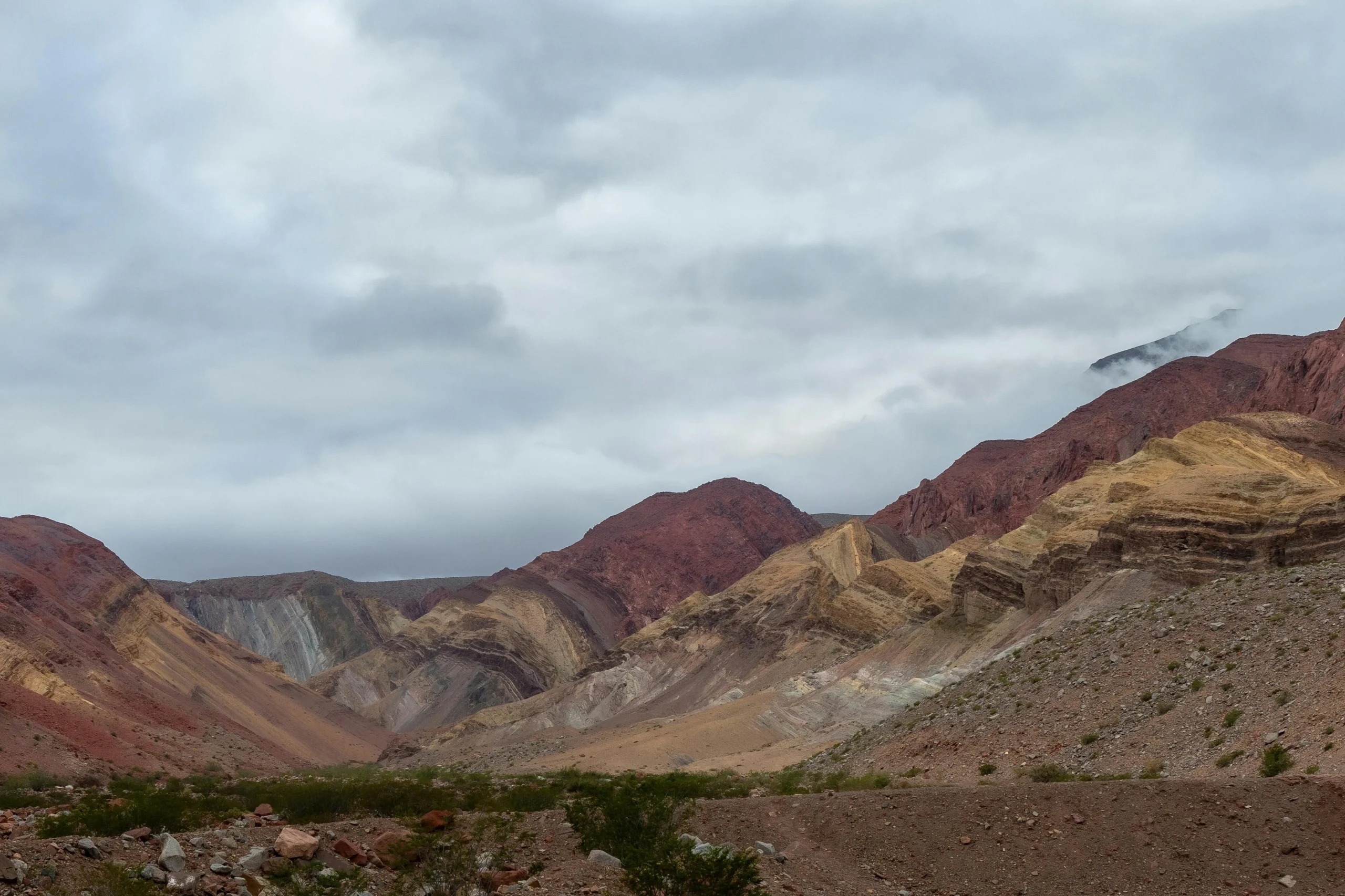
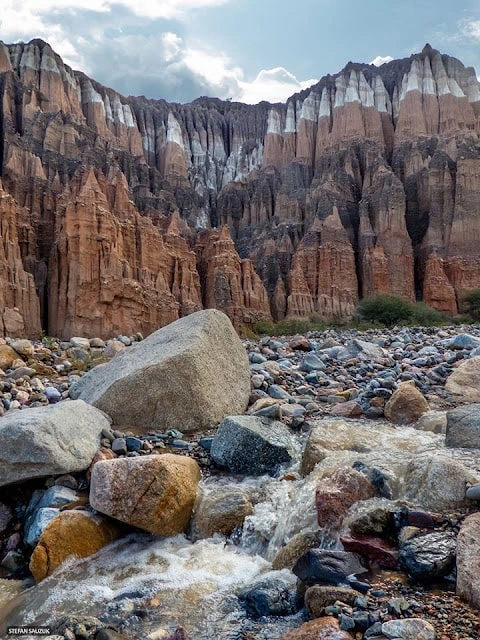
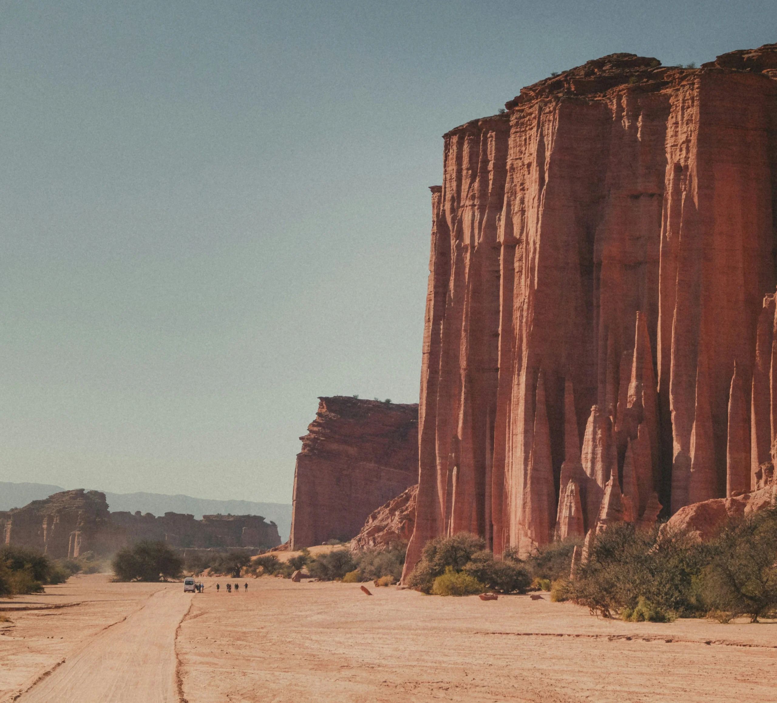
Day 2: Starting from Villa Vil we will visit the Castles. The area in general contains various natural attractions of geological origin of great geomorphological interest located in the Pedregal River basin (a very descriptive river name, by the way). The castles, for example, of great visual impact due to their color and peculiar shapes, are nothing more than rocky outcrops of sedimentary origin formed from pre-existing rocks eroded by external agents such as water and wind. These formations are made up of rocks of different granulometry, which gives them the possibility of being eroded differentially (at different rates), producing very striking shapes.
The latter can be seen in the cones, gullies, “totems” of balanced rocks (pedestal rocks) and columns and hollows that in one sector give the appearance of a giant cathedral organ. Night in Villa Vil (Catamarca)
Day 4: Departure to Antofalla, a Kolla Atacameña indigenous community located near the Antofalla volcano (6400 masl) passing through the Calalaste ravine, Vega de Los Colorados and the Antofalla salt flat, the longest in the world. (Lunch) Return via Quebrada del Diablo, entering the salt flat to observe the extinct geysers, called Ojos del Campo. Throughout the trip we can observe the flat landscape, contrast of colors and native fauna (vicuñas, foxes, suris llamas)
Night in Antofagasta de la Sierra (Catamarca)
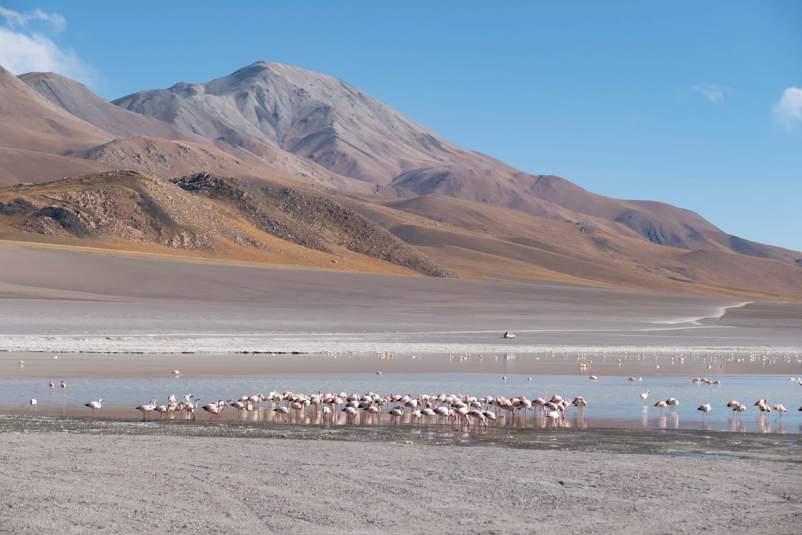
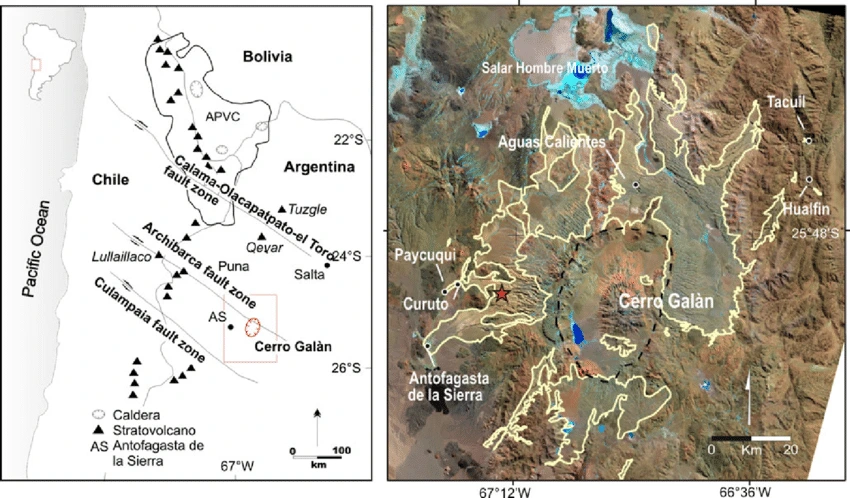
Day 5: We leave for the Galán Volcano, passing by petroglyphs, Rio Real Grande (viewpoints), Galán Crater, fumaroles, we go around the crater, to go to the Hombre Muerto salt flat.
Night in Antofagasta de la Sierra (Catamarca)
Day 7: Excursion to the Balcón del Pissis. Route of the six thousanders, San Francisco Pass, Indio Canyon, Night in Fiambalá (Catamarca).
Day 8: Saujil Dunes and Taton Hot Springs Night in Fiambalá (Catamarca).
Day 10: Chilecito Visit to the La Mejicana Museum and Cable Car
The La Mejicana Mine is a gold mine located on the Famatina Hill at 4,600 m above sea level (General Belgrano) 34 km from the city of Famatina in the province of La Rioja, Argentina.
To transport the large amount of mineral to Chilecito, what was at the time one of the largest engineering works in the world was built: a cable car, which was completed in 1905, with a length of 35 km and is currently part of the monuments and historical sites of Argentina.
Towards the end of the 19th century, Famatina became one of the most important districts with production of gold, silver, iron, copper and lead.
On National Route 40, at the southern entrance to Chilecito, the imposing rust-orange structure of Station 1 of the Chilecito-La Mejicana cable car stands out. With more than a century of history, you will discover a construction that is unique in the world. A transport system that runs 36 km in a straight line from 1,100 m above sea level in Chilecito and up to almost 5,000 meters at the height of Famatina. Along the way, 262 towers, 9 stations and 6 boilers mark a geological circuit that invites you to discover (on foot, by mountain bike, car (between stations 1 and 3), 4×4, mule or horse) the ghostly and disturbing ruins of what was once the most important mineral smelting center in Argentina.
Talampaya National Park: via RN40 at 119 km. From Chilecito we will visit these incredible formations
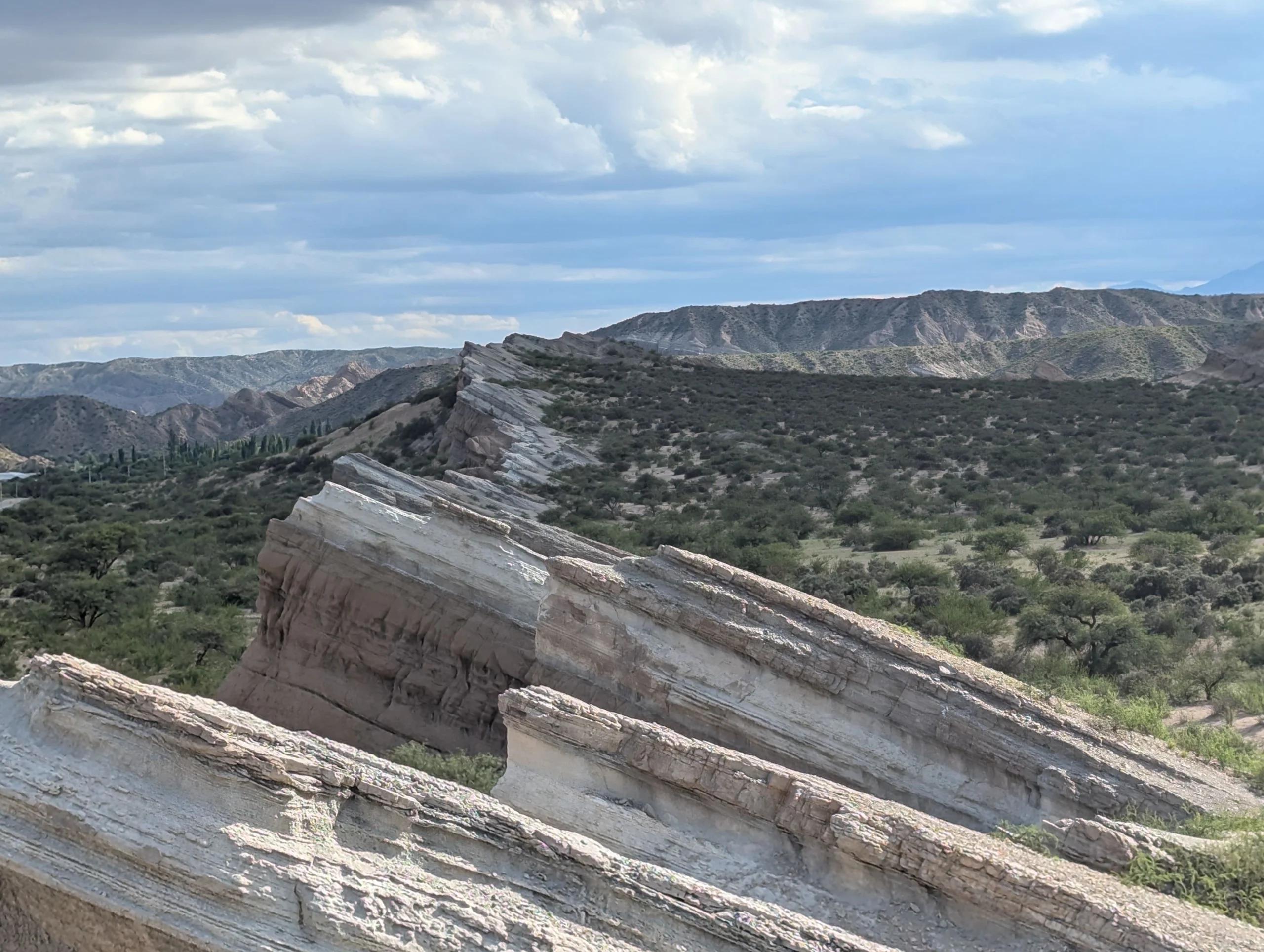
The Talampaya National Park is located in the center-west of the province of La Rioja in Argentina between the departments of Coronel Felipe Varela and Independencia. It was created with the aim of protecting important archaeological and paleontological sites in the area and occupies 213,800 ha (according to the National Parks Administration).1 It is adjacent to the provincial park of Ischigualasto located in the province of San Juan, also known as the Valley of the Moon. In 2000, UNESCO declared both parks as Cultural and Natural Heritage of Humanity in America. The name Talampaya corresponds to the extinct Cacán language and means: dry river of the Tala. Talampaya shares the Triassic geographic basin with Ischigualasto. This entire geological basin is considered one of the most important paradises in geological material in the Argentine Republic. The park has rocks that document the evolution of the planet for more than forty-five million years, being, for example, a witness more than 250 million years ago to the division of the supercontinent Pangea.
Night in La Rioja
GeoTours your perfect escape with tailored travel services, ensuring every detail of your dream vacation
Copyright © 2025 GeoTours of the Americas All Rights Reserved.